Immigration in the U.S.
Presented By

Liz Alarcón: Today we are going to talk about something that means a lot to a whole lot of people, all around the world.
Maribel Quezada Smith: And that is?
Liz Alarcón: Borders. No matter who you are or where you live, if you want to move around this world you will eventually come up against a border. But sometimes, a border isn’t what we think it is? Our Producer Charlie Garcia, has been looking into these questions
Charlie Garcia: Hello Liz & Maribel, so yes, something I think about a lot is how a border by itself, holds no existential relevance. It’s just an imaginary line someone drew on a map, probably hundreds of years ago. One side often doesn’t look any different from the other, and if you didn’t know where you were you could stumble across and not even know it. But, at the same time it also holds so much relevance, because a border can decide who is free, who is not, who has opportunity and who does not, sometimes it even decides who can live.
Maribel Quezada Smith: That’s heavy, Charlie, but I agree. It doesn’t necessarily exist, but in so many ways, the border does. Like you said, it can divide us as well.
Charlie Garcia: Yea, it feels like an immovable force, often with giant metal fences and faceless police. But actually, they can be much more flexible than some people realize. And I have a story about this that took place right on a line drawn between Mexico and the US.
So before 1848 The Border between Mexico and the US looked very different from today. That’s because a lot of the present day United States WAS Mexico. California, Nevada, Utah, New Mexico, most of Arizona and Colorado, and parts of Oklahoma, Kansas, and Wyoming were all originally part of Mexico. But starting in 1846, the US fought a bloody war against Mexico that resulted in The Treaty of Guadalupe Hidalgo. And we call this a treaty, but considering that US soldiers were occupying Mexico City at the time, they didn’t really have so much choice in the matter. But this allowed the US to take more than half of Mexico’s land and essentially decide where the new border would sit. And where did they decide? Of course, The Rio Grande.
Rodney Sauter: I don’t think that they really considered the implications of what it would mean to have that free flowing river be an international boundary. It was just a good line on a map.
Charlie Garcia: This is Rodney Sauter, a park ranger at Chamizal National Memorial, a small monument that straddles that line on the map. The new border between the two nations was officially designated to be, the deepest channel of the Rio Grande river, which sounds like a great marker, except that…rivers are not fixed in place, and over the years this river started to move, until eventually
Rodney Sauter: there was a major flood that pushed the Rio Grande further south in the Paso Del Norte region.
Charlie Garcia: In 1864 massive flooding actually caused the river to jump its banks and carve out a new path about 700 acres into Mexican territory. And there is actually a geological term for a river that does this. It’s called avulsion, which comes into play later in the story.
Maribel Quezada Smith: Wait, so the river moved, but it was supposed to mark the boundary, so what did that mean for the border?
Charlie Garcia: Well, that is where the problem started.
Rodney Sauter: Citizens from the United States sort of made an assumption that because the river had shifted south they figured, okay, we can move into this land. Of course that was not the perception in Mexico.
Liz Alarcón: Okay I see where this is going.
Charlie Garcia: Yes exactly. Mexican farmers who had been farming the land for years were all of a sudden told that they were not welcome anymore. And this is what came to be known as the Chamizal Dispute, since the region was referred to as El Chamizal. And 700 acres might not sound like a lot, it’s only a few miles. But remember that just 16 years before the US had essentially stolen half of Mexico’s territory, so they were naturally a little sensitive to losing any more land, and this is where they decided to draw the line. Over the next handful of years there were dozens of complaints by Mexican landowners and the government around the issue, and the response from the US citizens who’d come into possession of the new land, was more or less to stick their fingers in their ears and ignore it all together. So this issue stretched on and on, continuing to cause tension, until finally in 1911 it was decided to create an international panel with a member from the US, Mexico, and Canada to decide who owned the land, once and for all. About 30 years before, due to similar disputes the two countries did strike an agreement saying that if the River moved slowly then the border moved with it, and if it moved quickly, aka our favorite word avulsion, then the border would not move. The US argued that the river had moved slowly and that because Mexico didn’t contest the issue soon enough we should keep the land. Mexico argued that in fact, no the river did move abruptly so the border doesn’t move with it, and we did actually contest it, a bunch of times! And so it all came down to a tie breaking vote, but from the Canadian representative, who sided with… drumroll… Mexico.
Liz Alarcón: So that was it, the US gave the land back to Mexico?
Charlie Garcia: Well, no not exactly, I mean not at all actually. The US did not agree with the decision, it was deemed not satisfactory because instead of deciding that all the land would go one way or the other, they split part of it. So the US gov’t said, nope sorry, you don’t have the authority to do that, so we’re keeping the whole thing.
Liz Alarcón: Ugh, of course we did. Honestly, it doesn’t surprise me at all. That totally sounds like something that the US would do.
Charlie Garcia: Yes, so for the next 50 years the area moved into very murky territory since no one really knew who was in charge. Slumlords squeezed money out of tenants, garbage dumps and slaughter houses that no one else wanted started to pop up. There was even a secret bar called “The Hole in The Wall ” that was built where the river looped back towards the US creating a Mexican alcove on the US side. So right along the border, customers could enter the US side, where alcohol was illegal under prohibition, walk over to the Mexican side and drink a cold beer. This was quickly shut down by customs. But eventually US veterans from the Korean War began to build houses in the area with money from the GI bill and The Chamizal turned into a community of about 5,000 residents. Meanwhile on the Mexican side of the border people continued to become more and more upset. Now, This was all until something happened that would fundamentally change the relationship between the US and Mexico.
Clip: This government as promised has maintained the closest surveillance of the Soviet military buildup on the island of Cuba. Within the past week, unmistakable evidence has established the fact that a series of offensive missile sites is now in preparation on that imprisoned island.
Charlie Garcia: During the midst of the cold war, where capitalist USA and communist Russia were wrestling for power around the globe, a US spy plane discovered Soviet Missiles in Cuba aimed at the United States, triggering the Cuban Missile Crisis. At this time, many Mexicans were actually in support of the leftist Cuban government, and believed in communism. And the proposition of a communist leaning Mexico became a major concern for President Kennedy. This is where the Chamizal saga came back into the picture. Here’s Rodney again.
Rodney Sauter: Nationalists and communists in Mexico had been making an issue basically to say that the United States could not be trusted to hold to its word. And so with the backdrop of the cold war, there was basically the right set of circumstances to finally resolve this issue.
Charlie Garcia: So with this new found motivation, President Kennedy took a trip to Mexico.
Clip: Today, the people of free democratic Mexico come together to welcome the president of the United States. John F. Kennedy and Mrs. Kennedy. We share a border of 2000 miles. Over 3 million of our citizens in the United States are descended from your citizens. Most of all, we are both children of revolution. And it is my hope that the spirit of our revolution in the United States is as alive today in our country as is the spirit of revolution here.
Maribel Quezada Smith: Well, that seems pretty opportunistic. Now that there’s something in it for them, they actually want to respond, so now they care and they want to do something about it.
Charlie Garcia: I can’t say I disagree, andI think this is just part of how international politics work. But motivation aside, now the plan was in motion and the 1911 decision that had previously been ignored had already hammered out most of the details. Now the challenge was to figure out exactly how to return this land back to Mexico, now that it was home to over 5000 US Citizens, many businesses, and had been considered part of El Paso for the last 100 years. US-Mexico ambassador Thomas C. Mann and his team had to initially keep the negotiations quiet, so as to not rock the boat,and they found a unique strategy.
Rodney Sauter: They went to the local Esso station and purchased one of their maps. And they drew lines and took them back and forth, between the United States and Mexico. So that there wasn’t really like an official public record of the negotiations, because that was very sensitive because it was gonna impact people, particularly in the United States.
Maribel Quezada Smith: That’s crazy. They basically created international boundaries by drawing lines on gas station maps.
Charlie Garcia: I agree, it sounds crazy. But you would be surprised how much of the modern world was carved up by a bureaucrat with a pen. To be fair, there were several years worth of complex negotiations between the two nations that involved federal, state, and local officials on both sides, and the respective boundary commissions. It was a big task to solidify the deal. So despite concerns from residents and business owners, the government went on to force the sale of properties in the area. The 5600 Americans who called Chamizal home had to pack up and leave.
Rodney Sauter: Mostly Mexican American inhabitants in these neighborhoods. And many of whom were world war II veterans had just served the United States, and then, you know, within fewer than 20 years, they’re being asked to move out. Imagine if you were told by the government you had to move. I would think that’d be something pretty difficult to adjust to.
Maribel Quezada Smith: Yeah, that would be incredibly difficult. To be told that all of a sudden, you have to pick up and move to another area. Just pick up your home?
Charlie Garcia: Yeah, I think it would have been very hard. But by most accounts, the homeowners were compensated fairly and even had their moving expenses paid for by the government. But of course for some, leaving a home that they had built themselves was about more than the dollar amount .
Clip: The United States is not as big today as it was at this time yesterday. President Johnson and President Díaz Ordaz of Mexico met at the border today and ended an old dispute.
Charlie Garcia: On December 13, 1968, in the final of several ceremonies, President Johnson who took over after Kennedy’s assasination, and Mexican President Díaz Ordaz simultaneously pressed 2 red buttons, which actually weren’t hooked up to anything. But it gave the engineers a signal to blow a channel and allow water to be released into the brand new 5 mile long, concrete basin that had been co engineered by the 2 nations. Essentially a big concrete scar in the earth meant to represent a river. But this was now an unmovable river, no longer controlled by nature but instead controlled by humans. And this is where we sit today. So I had one last question for Rodney. Do you think the river will move again one day?
Rodney Sauter: I would say it was engineered to an extent that it shouldn’t, that being said, it’s always possible.
Charlie Garcia: Today there are national parks on both sides of the chamizal, and both governments take pride in the fact that this issue was solved diplomatically, without violence. But for me, This story is less about a dispute between nations and more about a dispute against nature. To quote Javier Loera, War Captain of the Ysleta del Sur Pueblo Tribe, who’ve lived along the river for hundreds of years. He says, ” to me it’s just a geopolitical division among these two relatively new nations…. It’s just a political barrier that divides two sides of the earth that have always been here.”
Liz Alarcón: Powerful and true. Thanks for this history lesson, Charlie. You can subscribe to the pulso pod wherever you get your podcasts, and if you like what you heard, please leave us a review on apple podcast and tell a friend to give us a listen. Have questions or story ideas to send our way? Send us an email to [email protected]. This episode was produced & written by Charlie Garcia, Editorial oversight by Liz Alarcón. Music & Audio Engineering by Julian Blackmore. Special thanks to Gina Hernandez at Chamizal National Memorial.
Latest News
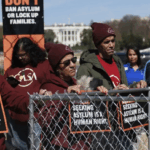
Accessing asylum in the U.S. will now be harder than ever
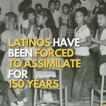
Latinos Have Been Forced to Assimilate for 150 Years
“The Alien Enemies Act” is More Dangerous Than You Think

What’s the State of the Economy Before the Election?